And here we are

Back home again. This time we are home indefinitely and there are no future caravanning plans; after four years it does feel a little weird. Especially when you leave 33 degrees of sun and balmy weather and come home to this (see pic below). It does make you question your judgement.

Which places do we like the most? Well, there’s lots of places, but we both agree the south coast of Western Australia is hard to beat. To quote me, all the beaches along this stretch of coast SE Western Australia sparkle with pristine sands, and mercifully the only things missing are cafes, shops, houses, and assholes. There are also stunning natural landforms, towering forests of ancient trees, interesting history, and nice people. You can remind yourself about why we like the area so much here, here and here. We would travel back there again, no question.

And I can’t go past Coral Bay, so good we go there twice. Swimming with humpback whales, whale sharks, manta rays, and turtles is indescribably joyful and, in every sense of the word, amazing. Different every time, and every time a delightful wonder.

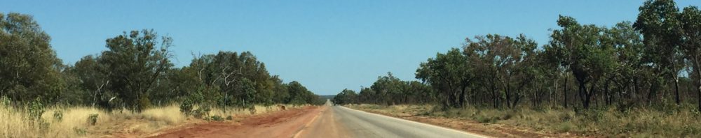
The trip across the Nullarbor is also a treat – read out it here and here. In fact, I love all the long outback drives. Each Roadhouse is an opportunity to experience another slice of Aussie life – with all its shades of good and bad.

What would we do differently? Not much, though we have a list of things we should’ve (would’ve, could’ve, didn’t) bought/buy. These include a blow-up paddle board/kayak – there were waterways we would have been able to explore further, and just general mooching around on the water; an electric chainsaw – for firewood when free camping in out of the way places, and fending off potential serial killers – this is Australia after all; a coffee machine – for obvious reasons; a roof rack, a battery drill with an adjustable torque setting, and some easy attach anti-flap clamps for the awning.

What were the unexpected delights? Random art projects, be it on grain silos, dams, water towers or city walls. Give an Aussie a blank space and they’ll slap a mural on it – and they are fantastic. The images generally portray some aspect of the history or people of the area. Sometimes you stumble on a stunning image in the middle of nowhere, other times you can spend some time meandering along a mapped out trail which leads you to places you’d otherwise miss.

Meeting some wonderful people at campsites and freedom camping along the way. There are a lot of the aforementioned assholes as well, but most people are generous with their time and tips about places to visit, camping information, and campsites – sometimes too generous, and it’s hard to get away.

Hot Springs – we never had a clue about the Great Artesian Basin that sits under a huge chunk of the mid to north east, and the many hot springs that are available.

floating down the river at Bitter Springs

Did you go everywhere? No, but we covered a lot. Colour coding on the map shows where we did go, and when. The blue line is 2018 is a precursor to caravanning – we flew to Darwin, hired a car and drove to Broome. We met so many campers and caravaners on the road we see no reason not to join in. So 2019 is the yellow trail; 2020 we all stay in our bubbles at home; 2021 is the pink trip across the Nullarbor and up and down WA; 2022 the purple took us from Perth almost the whole way round, ending in Mellbourne for a return a couple of months later in December /January 2023 to visit Tasmania. The murky orange, 2023, is our last trip along the Queensland coast.

All in all six, trips trips between April 2019 and October 2023 – no travel on 2020; 103 weeks of Aussie adventures. The Landcruiser had 18,000km on it when we bought it for $A91,000, and 95,000kms when we sold it for $A80,500. It was a machine – absolutely no problems, took us anywhere and everywhere, hauled us out of sand, rolled over some ugly terrain and didn’t miss a beat.

The caravan has new Kiwi owners who are going to live, work and travel around Australia for the next few years. They got a bargain.

end of an era, and yes, Walter the koala came home with us

How much did we spend on diesel? Don’t ask, don’t know, don’t care

Will you go back? No immediate plans

Do you recommend it? Hell, yes.

There’s water under here

Judging by these last few blogs, I seem to be developing an obsession with water. We tend to think of inland Australia as a huge desert, and by and large this is true. However as we cross into Northern Queensland we remember the Great Artesian Basin (GAB), sits beneath us. It is one of the largest underground water sources in the world, and Australia’s largest groundwater basin, holding 8,700 million millilitres. I’m not sure what that looks like, but I am sure it exceeds Department of Health daily guidelines. Much of the water in the GAB entered when the climate was much wetter and “they” estimate the water in the south-west of the basin is two million years old. Imagine – water off a dinosaur’s back, available for your tap.

red is the intake area, yellow the GAB, blue the concentration of springs, and arrows show the direction of flow

The 1,000+ km drive from the NT/QLD border through to Townsville on the east coast sees us retracing parts of our 2019 trip across Northern Queensland. Revisiting Camooweal, 14kms over the border, we find little has changed except the price of diesel – this from my July 2019 blog Not surprisingly, you pay more for things the further you are from civilisation, or competition. The least we’ve paid for diesel is $1.45 a litre (there’s no road user tax) and at Camooweal we pay the most at $1.82. Oh how we laugh to read that. We do not recall paying less than $2 a litre anywhere this year and Camooweal is charging $2.67. I also note it was 35°C (Sept 2019) and this year, in July, it’s a more manageable 26°C.

We don’t go back to the caves, but do take the time to visit the excellent Drovers’ Museum on the outskirts of town. There are fantastic displays including maps of the old stock routes, but best of all we have an old codger telling us about everything we ever wanted to know (and more) about droving.

Droving routes, taking months to get thousands of cattle to rail head or ports

The head drover hires on the other staff, gets the supplies in – which he is unable to pay for until he is paid on delivery of the stock – and to manage the whole drove from start to finish, including finding grazing and water. The horse tailor, a great job title and nothing to do with fashioning outfits for the men or the stock, has to look after about 6 horses per stockman plus 20 or so pack horses, depending on herd size, balancing the loads, knowing what’s in every pack, which horse is for which stockman, and so on. The cook manages supplies, though with basics of salted beef, damper and tea there’s unlikely to be any Instagram worthy pics. Men might be two years on a drove, travelling to the station from a distance, and then about 8 miles a day driving the stock to the railhead or port. Wearing the same set of clothes. Those were the days.

The very definition of wide open space

The landscape we drive through does change. There are vast sunburnt plains of desiccated grass where massive acreages of cattle stations eke out their existence. Sometimes there are fences lining the road, often not, and the evidence of wandering cattle is a beast four legs to the sky being ripped apart by raptors. Wedge tailed eagles, kites, and screaming crows circle the skies looking for an easy meal of roadkill and seldom experience disappointment.

The road surfaces vary but there are a lot of long straights. The colours change from rich robust reds to softer pastels of mauve and dusky pinks and greys. The night skies are spectacular. With no ambient light for hundreds of kilometres the constellations are easy to find – well they would be if you knew them – and the stars shimmer. One of the challenges when taking photos in the outback is scale (and only using an iPhone). To get any sort of panoramic shot trying to show the vastness of the scene, you find everything fades into the distance.  If you zoom in, you lose the magnificence you want to capture.

Mount Isa is not a place to linger in our experience, unless it is for the rodeo, which we gave a good nudge in 2019, so we bypass and carry on towards Julia Creek. We are meeting Emily, an old friend who is in her camper van travelling down from the North. In the meantime we rendezvous at a free camp at Corella Dam with new friend Erica and her mate Trev. We met Erica last year when she was managing the station stay at Peedamulla in WA. This is another joy of life on the road – the opportunity to meet some cool people, and then arrange to find them again on your next trip! We circle the vans as if we are a wagon train. If you were born before the Bag of Pigs invasion and your family owned a TV set you will know about circling the wagons and remember the TV show Wagon Train – or Gunsmoke. Or The Virginian. Or Rawhide. Spuds roasted on the edge of the fire, marshmallows in the embers later and plenty of wine. Time with friends is seldom wasted.

So we do it again. This time with Emily and exploring the wonders of Julia Creek, where we learn about the aforementioned GAB, and the tiny marsupial, the Julia Creek Dunnart. if you’ve never heard of a dunnart I am not surprised – this country has a never ending supply of largely anonymous marsupials. This one is as small as a mouse and a lot cuter. It is also endangered so they are fencing off a little sanctuary to increase numbers. Clever little thing that it is, having stuffed itself silly in the good times it stores fat in its tail – no body shaming from me – and then in the dry season when there’s little food, it shelters within the cracking clay soils, living off its stored fat.

The Julia Creek Dunnart

There are quite famous artesian baths at Julia Creek – can’t stop that hot water bubbling up -but the air temperature (34) is hot enough we opt for the swimming pool. It literally takes our breath away – the water is about 16 degrees – funnily enough, we are the only ones in the pool.

It’s all about the pearls

Broome is a interesting town with an ironic history: a booming pearling industry in the late 1880s sees more Japanese than European settlers living there, and a strafing attacks by Japanese Zeros on the 3rd March, 1942. Since our last visit in 2018, when there was no visible story of this major event, most Australians not knowing Broome was attacked, an evocative installation is now at Roebuck Bay. Japanese fighters strafed not only the Broome airfield, but also 15 flying boats at anchor. These were transferring Dutch evacuees to safety from Java which had been invaded by Japan. The nine figures of the installation stand looking out to the site of one of the fifteen wrecks, a Catalina FV-N. There are silhouettes of nine Zeros arranged in three flying formations depicted coming from the southwest, the flight path they took that day. The stories and quotes written on the figures are arranged into 9 themes: The Chaos of War, The Movement of People, The Attack, The Rescue, The Survivors, The Impact, Kudo, The Wrecks, Reflection and Reconciliation. The stories are both heartbreaking and inspirational.

Nine Zeros, Nine Stories on the Roebuck Bay

If is fair to say Broome is the equivalent of a seasonal retirement village. Those living in Perth and south flock north for Winter, many staying at the same caravan park, probably in the same site, with the same friends they have at home. Same, same, but warmer.

On advice from friends we head up the more remote Dampier Peninsula towards Cape Leveque, leaving the caravan in Broome. We remember flying over this wild part of the world back in 2018, and a magic trip to the Horizontal Falls (which I wrote about on my former blogsite). David Attenborough calls the falls the Eighth Wonder of the World. Here the tide runs full tilt between narrow cliffs and appears to flow, well, horizontally.  It is thrilling and mind bending, taking the powerful boats up through the narrow gap where water defies the laws of nature.

The main road up to Cape Leveque is recently sealed, long and straight. We continue past our turnoff and go into the tiny Beagle Bay Community to see Sacred Heart Church – not because I suddenly need to go to confession, but to see the beautiful pearl shell altar and side altars. It is quite spectacular.

The beautiful pearl shell altar of the Sacred Heart church

The Stations of the Cross (ask a Catholic if you can find one) feature pearl shell frames and are painted in German Impressionist style. They date from 1949 and include themes and symbols meaningful to the local Aboriginal community. Yes, someone really thought this.  At the risk of (further) inflaming any Catholic readers, I suggest what happens to Aboriginal people as a result of European arrival is on a par with crucifixion.  I appreciate the beauty of the church from a purely aesthetic viewpoint.

From Beagle Bay to our accommodation the 26km road is a 4WD track, and several times I think we may not be going the right way.  Sandy in places, rugged in others with borders of long grass so you can’t really see much other than what is in front of you. Other sections give out wide views across the seedy grass.

And then……. swaying palms, blue ocean, white sand.  

No longer an active pearling factory, the pearl divers quarters are now basic but airy queen rooms:  five opening out on to the water and five facing inland.  We are in the waterfront and thank goodness for the cyclone shutters, which sit at about 60 degrees down, shade the room from the easterly sun, but windows that allow in the breeze.  Anyone who doesn’t believe I am ever up early enough for a sunrise would generally be right. But in this case I have no choice as the dawn shines right in my eyes – until I realise I can drop the shutter the night before.

The days are spent walking, fishing (for Scott), crabbing, talking, eating (crab and fish), drinking, reading, learning about the history of the pearl industry, and pearls in general. Steve, who started the farm in the 1970s, and his partner Erin (a lovely Kiwi) are great hosts and generous with their time and resources.

And a lasting memory of Broome: we go to the Sun theatre, the world’s oldest operating picture garden to see Top Gun, Maverick. Broome airport is less than half a kilometre from the main street theatre, and about half an hour into the movie there’s a deafening roar as a jet flies overhead at no more than 500 metres – it takes a moment to realise it isn’t the movie sound effects, but then we realise – everyone laughs and cheers – go Qantas! That’s service.

The Kimberley region is one of the most remote in Australia, and one of the world’s last wilderness frontiers. The region is three times larger than England with a population of less than 40,000. think about that for a minute. It’s a empty space bigger than Boris Johnson’s ego. Extending over Australia’s entire north-western corner, the Kimberley is  spectacular: rugged ranges, deep gorges, semi-arid savanna and a largely isolated coastline. Broome is the eastern anchor, and we set off to Kununurra, 1,100 kilometres away. come with us.

The mysterious lottery of managed isolation

Well I guess we should buy Lotto tickets. 

Some of you know we have secured MIQ (managed isolation and quarantine) spots for the 18th October. This is no mean feat, as even a cursory reading of the media reveals. On “opening day” of the new booking system, the 20th September, over 26,000 wannabe returnees crowd into a virtual waiting room between 8:00am and 9:00am New Zealand time. 

At 9:00am a virtual hand, possibly Maradona’s non virtual hand of God, randomly allocates those 26,000 into a queue. It doesn’t matter if you are first in the waiting room, or 26,000th, your place in the queue is the luck of the draw – or lack of.

Prior to this date, we register on the site: it is possible to register more than once if you are a couple, family or group, as each person in turn may take a lead. I register us as the Marshall-Wilsons and Scott registers us as the Wilson-Marshalls. We look at the dates when there are flights from Perth to Auckland – this is tedious: you can’t search Perth – Auckland, you have to look at every day in turn and see which flights are flying into NZ that day.  There are only two flight dates from Perth before the end of the year that we can see: 18th and 25th October. We have always planned to come home around the end of October so the 25th looks good for us.

Match Day.

The alarm rings. It’s 4:30 am (imagine my joy), but in NZ it’s 8.30am. We both fire up our laptops, go to the site and enter our passport numbers. There’s nothing to do then but watch the countdown to 5.00am (9:00am NZ) and await out fate. When the random queue forms at 5:00am Scott is a surprising 2200ish and I’m in the mid 4,000s. PTSD means we do not remember the exact placings, and irrationally, are too terrified to take screen shots in case we lose our places.

By about 5:30am Scott is through the (non existent) door into the booking office, where the staff are invisible. The 25th is gone, the choice is Hobson’s and we book for the 18th October.  I drop out to let someone else through. We then go to the Air NZ site and book our flights.  We then have 48 hours to enter the flight details into the MIQ system or we lose our spot.

So our days are numbered – for this trip at least. Now comes the scramble to organise storage for the car and caravan for an undetermined period of time. Some initial enquiries are not promising. So many people from the Eastern states (New South Wales and Victoria in particular) are unable to get into WA to pick up their caravans this year, the storage facilities are full. WA has been so stringent in its border closures, international and local, who knows when we will be able to return. 

We love our travels here and I would be happy to stay on if we had to. WA is good to us and we are both now fully vaccinated. It is immeasurably safer from COVID than almost anywhere else, including NZ at this point; there’s more chance of contact in MIQ than we have now. That aside, I do feel a bit guilty that we have an MIQ allocation when there are so many people in desperate straits who need to get home.

On the plus side, as we will be back in NZ within six months, the NZ Government won’t be clawing back our superannuation;  I’m running out of drugs, so won’t have the trauma of getting them sorted here; my Drivers Licence runs out in December so I can renew that;  Scott can go on the KTM motor bike ride at the end on November; we will be home for what passes as Summer;  we will be home to meet a new great niece/nephew and excitingly, for the birth of a grandson; and not least, we will see many of you. 

And we did buy Lottery tickerts – it’s drawn tonight and $30 million is up for grabs – we’ll let you know.

NZ826 leaves Perth at 9:15 pm on 17/10 and arrives at Auckland 8:20am.  Yes, we will be in front of the plane having a large gin and a lie down.

It is a mystery where we will be put in isolation. We request Huka Lodge or Blanket Bay, but probably we’ve used all our luck and will score the Waipuna Hotel and Conference Centre. 

We are keen to hear from anyone who has suffered through MIQ and can offer tips to make it easier. We’ve already thought of alcohol.

Simply gorgeous

Does the word gorgeous come from the fact gorges are so gorgeous? I pose this question to myself constantly as we explore the stunning chasms that carve their way through Karajini National Park.  Set in the heart of the Pilbara, just north of the Tropic of Capricorn in the Hamersley Range, Karajini covers 627,422 hectares and is WA’s second largest national park. For the most part it is dusty plains punctuated with rocky hills ( they call them mountains but you and I know 1200 metres is just a hill ) jutting up out of nowhere. Then you arrive at the edge of a cliff that takes you down a precarious path to a lovely natural swimming pool. Our favourite is Fern Pool in Dales Gorge, and we reach it after a long walk around the rim of the gorge, then a descent and a long walk along the gorge floor.  A waterfall cascades at the end of the pool which is about five or six metres deep. Someone dives in and loses their sunglasses; Scott has his mask, fins and snorkel with him and after a few dives manages to find them, much to general delight.

Fern Pool in Dales gorge, Karajini

Throughout the park there are more than half a dozen accessible gorges and swimming holes – all require some clambering down and climbing out, sometimes over quite unstable surfaces, and all are worth the trouble. I run out of words to describe all of these wonders: they are magnificent, deep chasms, many fed by waterfalls, fringed with greenery and mind blowing rock formations.  

the rock walls are a constant fascination

The permanent water supply supports some native trees, such as the Rock Fig  and Rock Kurragong which miraculously cling to the rock walls and flourish.  Fluffy purple Mulla Mulla, bright yellow cassia and wattle – 65 species no less – spring up and show their full glory against the red earth.

the will to live
Fortescue Falls, Karajjini, requires a long walk down

The Pilbara is a geological time map – It comprises the oldest and most ancient rock formations in the world. It’s true. Parts of the Pilbara are dated over 3.5 billion years old and the existence of stromatolites – the earliest fossil evidence of life on Earth – are present here and also nearby at Shark Bay out to the coast. The knowledge they were the only life for a couple of billion years before they raised the oxygen level enough to allow the development of other forms of life, us, for example, is astounding.

The night sky viewing is second to none and we sign up for an astronomical adventure with Phil, a man whose jokes have more corn than Illinois, Iowa and Indiana combined. But he has three telescopes and he knows his stuff. TMI (too much information) results as he reels off numbers of light years, degrees of heat, numbers of moons and how many Earths could fit onto other planets, and I tune Phil out and simply enjoy the beauty of a sky with no light pollution, and gasp at the images we see through the telescopes: Alpha Centauri, Jupiter, Saturn, the Moon and other nameless stars that are so much more than what they seem – like all of us.

the moon by iPhone via telescope

It has been a revelation – isn’t everything in this country? – to discover the Pilbara region and the diversity of landscapes. We now head west and will stay on some working cattle stations as we head to the coast again.

at home in Karajini
for those who like the flowers
for those who like a map

O for Ore-some

Many people dislike Port Hedland because of the never ending red dust and the overt industrialisation that gives the town its reason for being: it is the biggest bulk export port in the world, exporting predominantly iron ore, manganese, lithium, and salt among other things. 

the port of Port Hedland

However, we end up spending more time here than we thought we would just because it is all so interesting. We take some tours to find out more about this red dirt town. The Seafarers’ Harbour Tour takes us out into the harbour so we get up close and personal with the massive ships in port. The Twilight Tour takes us around the land based operations that feed the port.  The Eco Salt tour takes us out to the massive salt ponds and tells us about the traditional Aboriginal use of the land and how they are working together in the eco projects.  A city (I use the term loosely) tour clues us in to the history of Port Hedland including the lengths people must go to to batten down the hatches in cyclone season. The building code in Port Hedland is apparently the most stringent in Australia, requiring extensive roof fastening to prevent beheadings when roofing iron flies off during high winds.

The roof is reinforced with the battens running vertically down the walls, and the roofing iron is also battened

Iron ore is the reason for the existence of Port Hedland. The Pilbara holds the biggest deposit of iron ore in the world and the world is hungry for it, particularly China which takes 60% of the exports.  So this blog includes a lot of awesome facts and figures, but I still won’t be able to convey the massive entity that is this production.

More about the Pilbara in a future blog, but we know we’re there as we encounter more and more trucks on the road, quads – four trailers of ore – heading to the Port.  Couple that with huge trucks moving the biggest diggers you’ll ever see and it is wise to pull off to the side of the road when you see the flashing lights coming your way.

move aside for the over size loads

The ore is loaded on to very, very long trains for transport to the ships. The trains are three kilometres long and comprise 268 ore cars with a locomotive at each end and two in the middle;  each ore car carries 140 tonnes of ore.  I’ll do the maths for you, that’s 37,500 tonne per train and there’s a train an hour – and this is just BHP. The trains dump the ore, two carriages at a time onto conveyor belts – it takes 30 seconds – which transfer the ore to loaders then into bulk holds on the ship. There are 500 kilometres of conveyor belts around the Port, in case you are wondering. All the conveyors and loaders are autonomous and are run from Perth.

BHP is the biggest player in these parts, followed by FMG and the Johnny come lately to mining in these parts, Roy Hill, owned by the redoubtable Gina Rinehart. Yet Gina made so much money last year she gave all employees a 50% bonus on their salary (this is according to our tour guide). The various companies’ relative holdings are reflected in the number of berths they own for loading (see port map below – PPA are port authority general use). It takes four tugs to bring a bulk carrier in and out of the harbour. BHP own their own tugs, which they had custom built.

At any time there can be 60 ships at anchorage off Port Hedland for two to six days waiting for their turn to enter. Air Traffic control has nothing on the harbour dance. Ships must be a minimum of 14 days at sea (COVID restrictions) no matter where they come from, and when they dock seamen are not allowed ashore. The pilot is flown out by helicopter to bring the massive ships (360 metres long and 60 metres wide) into a channel only 190 metres wide. As the tidal flow can be up to 7.4 metres, there’s two sailing windows over a 24 hour period allowing 5 or 6 ships to come in to load; the turnaround time to fully load is 24-36 hours. When a fully loaded ship departs there is 24 centimetres, yes 9.4 inches, clearance to the harbour floor. And that is what a plimsoll line is for – to show the maximum depth for a fully loaded ship

The ship on the left is leaving, on the right it waits to load. The plimsoll line shows the difference between a fully loaded and empty bulk carrier.

What’s the bottom line? When iron ore was $100 per tonne, BHP was shipping $95 billion worth of ore a year. The latest price is somewhere around $220 per tonne, so you can double that. We understand it is $15 a tonne to extract, so I’ll leave it to you to do the maths and weep – or buy shares.

Rio Tinto is the world’s largest exporter of seaborne salt – meaning salt that is produced from evaporating seawater, as opposed to the Siberian version of mining salt – 5 million tonnes of salt every year, with most of it going to Asia and the Middle East for industrial use: in glass, industrial chemicals, and soaps and detergent.  We drive out of town to inspect the evaporation flats. The whole farm is 21,000 hectares, so that’s a lot of fish and chips and tequila shots. They say the operations are a biodiversity area with greater than 1% of the world population of Red-necked Stint, Curlew Sandpiper, Sharp-tailed Sandpiper and Red-capped Plover, of which we see none. Port Hedland is also the most important known Australian site for Broad-billed Sandpiper and the endangered Asian Dowitcher – of which we see none. Back in town we watch $4.5 million bulldozers crawl over massive salt mountains. The dozers have another $1million of salt specification protection applied before use, and this is repeated every 9000 hours.

So we are fans of Port Hedland – it isn’t pretty but it is interesting.

You need one big salt shaker
here’s a map to show the relative ship loading facilities

Gonna jump down turn around

and I’ll just bet you finished that line with “pick a bale of cotton”. I’ll be disappointed if you didn’t, because I was singing it, in my head at least, all day when we took the Cotton Farm tour in Goondiwindi.

We are now on the border, literally, of Queensland and New South Wales and this is big farm country – grains such as wheat, sorghum, barley and chick peas, and cotton. This is the type of place where the toilets at the caravan park are labelled Blokes and Sheilas, or The Old Fella and The Missus. You overhear conversations in the pub about whether there were many dead kangaroos on the road into town. A major town attraction is a statue of Gunsynd, a horse that ran third in the Melbourne Cup in 1972, (to be fair it did win 29 of 52 starts). The toilets here are labeled Fillies and Colts in case you are wondering.

Goondiwindi is a lovely town with an urban population of around 5,500, bulked up by about that number again when the districts are included. You feel you wouldn’t mind paying your rates (city taxes) as the facilities are so good: lots of green spaces, parks, sports centres and playing fields. We’re told that through dry periods they keep the town watered and green, to lift the spirits of the farmers when they come from their brown, drought ridden farms. Water is a tightly held, monitored and metered resource here, as we find when we tour the cotton farm.

The cotton flower is white for a day then turns pink before forming the boll, which you can see at the top right of the plant

As we drive towards Goondiwindi the roadside looks like giant bags of cotton wool have exploded. This isn’t too far from the truth as the cotton gets blown about during harvest, which is just finishing. Our tour takes us to one of the 1200 farms that grow cotton in Australia. Cotton planting is rotated with crops, and how many acres are planted, or if it is planted at all, depends on available water. Every drop that is taken from groundwater sources and rivers is allocated and metered. A system of gravity fed channels irrigate the crops and a tail drain collects any run off, which is returned to the dam. It’s a very tough life: in a good year you may get 11 or more 227kg bales to the hectare, but the last good years were 2012 and 2013. This year the crop will be about 7 bales/hectare with the break even price of $400 a bale. This year the price is $640.

Harvested cotton to the left and bales waiting to be picked up and trucked to the gin

What more do you need to know? How’s this – gin is an abbreviation of cotton engine. Ginning separates the seeds from the fluffy stuff. Cotton seeds can be used as stock feed, and if the oil is extracted it’s flavourless and low in cholesterol. We don’t get to see the gin working – health and safety – but Faye, our tour guide has a mini gin to show us the process.

Faye takes to the mini gin

As with every tour you’ve ever been on, the exit is through the giftshop – in this case, Goondiwindi Cotton, a shop created by a cotton family to diversify by adding a garment manufacturing operation. Questions reveal not all the cotton is local, some imported from California which just seems odd, though all the manufacturing is still local.

And here’s what you can get from a bale, though really, who needs 4,300 pairs of socks?