There’s water under here

Judging by these last few blogs, I seem to be developing an obsession with water. We tend to think of inland Australia as a huge desert, and by and large this is true. However as we cross into Northern Queensland we remember the Great Artesian Basin (GAB), sits beneath us. It is one of the largest underground water sources in the world, and Australia’s largest groundwater basin, holding 8,700 million millilitres. I’m not sure what that looks like, but I am sure it exceeds Department of Health daily guidelines. Much of the water in the GAB entered when the climate was much wetter and “they” estimate the water in the south-west of the basin is two million years old. Imagine – water off a dinosaur’s back, available for your tap.

red is the intake area, yellow the GAB, blue the concentration of springs, and arrows show the direction of flow

The 1,000+ km drive from the NT/QLD border through to Townsville on the east coast sees us retracing parts of our 2019 trip across Northern Queensland. Revisiting Camooweal, 14kms over the border, we find little has changed except the price of diesel – this from my July 2019 blog Not surprisingly, you pay more for things the further you are from civilisation, or competition. The least we’ve paid for diesel is $1.45 a litre (there’s no road user tax) and at Camooweal we pay the most at $1.82. Oh how we laugh to read that. We do not recall paying less than $2 a litre anywhere this year and Camooweal is charging $2.67. I also note it was 35°C (Sept 2019) and this year, in July, it’s a more manageable 26°C.

We don’t go back to the caves, but do take the time to visit the excellent Drovers’ Museum on the outskirts of town. There are fantastic displays including maps of the old stock routes, but best of all we have an old codger telling us about everything we ever wanted to know (and more) about droving.

Droving routes, taking months to get thousands of cattle to rail head or ports

The head drover hires on the other staff, gets the supplies in – which he is unable to pay for until he is paid on delivery of the stock – and to manage the whole drove from start to finish, including finding grazing and water. The horse tailor, a great job title and nothing to do with fashioning outfits for the men or the stock, has to look after about 6 horses per stockman plus 20 or so pack horses, depending on herd size, balancing the loads, knowing what’s in every pack, which horse is for which stockman, and so on. The cook manages supplies, though with basics of salted beef, damper and tea there’s unlikely to be any Instagram worthy pics. Men might be two years on a drove, travelling to the station from a distance, and then about 8 miles a day driving the stock to the railhead or port. Wearing the same set of clothes. Those were the days.

The very definition of wide open space

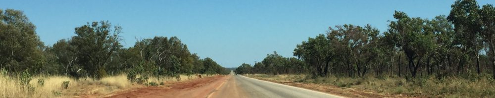
The landscape we drive through does change. There are vast sunburnt plains of desiccated grass where massive acreages of cattle stations eke out their existence. Sometimes there are fences lining the road, often not, and the evidence of wandering cattle is a beast four legs to the sky being ripped apart by raptors. Wedge tailed eagles, kites, and screaming crows circle the skies looking for an easy meal of roadkill and seldom experience disappointment.

The road surfaces vary but there are a lot of long straights. The colours change from rich robust reds to softer pastels of mauve and dusky pinks and greys. The night skies are spectacular. With no ambient light for hundreds of kilometres the constellations are easy to find – well they would be if you knew them – and the stars shimmer. One of the challenges when taking photos in the outback is scale (and only using an iPhone). To get any sort of panoramic shot trying to show the vastness of the scene, you find everything fades into the distance.  If you zoom in, you lose the magnificence you want to capture.

Mount Isa is not a place to linger in our experience, unless it is for the rodeo, which we gave a good nudge in 2019, so we bypass and carry on towards Julia Creek. We are meeting Emily, an old friend who is in her camper van travelling down from the North. In the meantime we rendezvous at a free camp at Corella Dam with new friend Erica and her mate Trev. We met Erica last year when she was managing the station stay at Peedamulla in WA. This is another joy of life on the road – the opportunity to meet some cool people, and then arrange to find them again on your next trip! We circle the vans as if we are a wagon train. If you were born before the Bag of Pigs invasion and your family owned a TV set you will know about circling the wagons and remember the TV show Wagon Train – or Gunsmoke. Or The Virginian. Or Rawhide. Spuds roasted on the edge of the fire, marshmallows in the embers later and plenty of wine. Time with friends is seldom wasted.

So we do it again. This time with Emily and exploring the wonders of Julia Creek, where we learn about the aforementioned GAB, and the tiny marsupial, the Julia Creek Dunnart. if you’ve never heard of a dunnart I am not surprised – this country has a never ending supply of largely anonymous marsupials. This one is as small as a mouse and a lot cuter. It is also endangered so they are fencing off a little sanctuary to increase numbers. Clever little thing that it is, having stuffed itself silly in the good times it stores fat in its tail – no body shaming from me – and then in the dry season when there’s little food, it shelters within the cracking clay soils, living off its stored fat.

The Julia Creek Dunnart

There are quite famous artesian baths at Julia Creek – can’t stop that hot water bubbling up -but the air temperature (34) is hot enough we opt for the swimming pool. It literally takes our breath away – the water is about 16 degrees – funnily enough, we are the only ones in the pool.

And then you meet people like this

Emma and James are those young people who help you believe good people exist in the world.  We meet them at a roadside rest area where we stop to stretch and change drivers, which we do every 100 or so kms.  Two people are sitting in the grass eating a snack. There are what look like bike trailers on the dirt in front of them.  When I go over to chat, I see the trailers are heavily laden carts, with two wheels and a handle.  

Emma and James are walking across Australia. You read that correctly. James started his trek pre Covid lockdowns and then couldn’t get into WA with border closures. With Covid dictating his passage, he suspended travel in Alice Springs.  

Now he and Emma are finishing the trip.  They have just come off 700 odd kms of the Tanami Road which runs from Alice Springs to the Great North Highway just south of Halls Creek.  Now, understand the Tanami Road is a sandy, rocky, rough 4WD road, not smooth bitumen, and they are pushing these carts.  I try one out for a few metres and yes, they are well balanced, but I can not imagine a full day pushing this in front of me.  With heat, flies, dirt, boredom and pain for company, then no hope of a hot shower at the end of the day.  Emma tells me they average 43 kms a day.

Why? You have to ask.  Why? They are raising money for Purple House, a charity that provides medical care for the remote indigenous communities they pass through on their journey. There’s a gofundme page and you can read more there. 

We offer water, food, a toilet, but they cheerfully decline. They are totally self sufficient. They are amazing.

Simply gorgeous

Does the word gorgeous come from the fact gorges are so gorgeous? I pose this question to myself constantly as we explore the stunning chasms that carve their way through Karajini National Park.  Set in the heart of the Pilbara, just north of the Tropic of Capricorn in the Hamersley Range, Karajini covers 627,422 hectares and is WA’s second largest national park. For the most part it is dusty plains punctuated with rocky hills ( they call them mountains but you and I know 1200 metres is just a hill ) jutting up out of nowhere. Then you arrive at the edge of a cliff that takes you down a precarious path to a lovely natural swimming pool. Our favourite is Fern Pool in Dales Gorge, and we reach it after a long walk around the rim of the gorge, then a descent and a long walk along the gorge floor.  A waterfall cascades at the end of the pool which is about five or six metres deep. Someone dives in and loses their sunglasses; Scott has his mask, fins and snorkel with him and after a few dives manages to find them, much to general delight.

Fern Pool in Dales gorge, Karajini

Throughout the park there are more than half a dozen accessible gorges and swimming holes – all require some clambering down and climbing out, sometimes over quite unstable surfaces, and all are worth the trouble. I run out of words to describe all of these wonders: they are magnificent, deep chasms, many fed by waterfalls, fringed with greenery and mind blowing rock formations.  

the rock walls are a constant fascination

The permanent water supply supports some native trees, such as the Rock Fig  and Rock Kurragong which miraculously cling to the rock walls and flourish.  Fluffy purple Mulla Mulla, bright yellow cassia and wattle – 65 species no less – spring up and show their full glory against the red earth.

the will to live
Fortescue Falls, Karajjini, requires a long walk down

The Pilbara is a geological time map – It comprises the oldest and most ancient rock formations in the world. It’s true. Parts of the Pilbara are dated over 3.5 billion years old and the existence of stromatolites – the earliest fossil evidence of life on Earth – are present here and also nearby at Shark Bay out to the coast. The knowledge they were the only life for a couple of billion years before they raised the oxygen level enough to allow the development of other forms of life, us, for example, is astounding.

The night sky viewing is second to none and we sign up for an astronomical adventure with Phil, a man whose jokes have more corn than Illinois, Iowa and Indiana combined. But he has three telescopes and he knows his stuff. TMI (too much information) results as he reels off numbers of light years, degrees of heat, numbers of moons and how many Earths could fit onto other planets, and I tune Phil out and simply enjoy the beauty of a sky with no light pollution, and gasp at the images we see through the telescopes: Alpha Centauri, Jupiter, Saturn, the Moon and other nameless stars that are so much more than what they seem – like all of us.

the moon by iPhone via telescope

It has been a revelation – isn’t everything in this country? – to discover the Pilbara region and the diversity of landscapes. We now head west and will stay on some working cattle stations as we head to the coast again.

at home in Karajini
for those who like the flowers
for those who like a map

O for Ore-some

Many people dislike Port Hedland because of the never ending red dust and the overt industrialisation that gives the town its reason for being: it is the biggest bulk export port in the world, exporting predominantly iron ore, manganese, lithium, and salt among other things. 

the port of Port Hedland

However, we end up spending more time here than we thought we would just because it is all so interesting. We take some tours to find out more about this red dirt town. The Seafarers’ Harbour Tour takes us out into the harbour so we get up close and personal with the massive ships in port. The Twilight Tour takes us around the land based operations that feed the port.  The Eco Salt tour takes us out to the massive salt ponds and tells us about the traditional Aboriginal use of the land and how they are working together in the eco projects.  A city (I use the term loosely) tour clues us in to the history of Port Hedland including the lengths people must go to to batten down the hatches in cyclone season. The building code in Port Hedland is apparently the most stringent in Australia, requiring extensive roof fastening to prevent beheadings when roofing iron flies off during high winds.

The roof is reinforced with the battens running vertically down the walls, and the roofing iron is also battened

Iron ore is the reason for the existence of Port Hedland. The Pilbara holds the biggest deposit of iron ore in the world and the world is hungry for it, particularly China which takes 60% of the exports.  So this blog includes a lot of awesome facts and figures, but I still won’t be able to convey the massive entity that is this production.

More about the Pilbara in a future blog, but we know we’re there as we encounter more and more trucks on the road, quads – four trailers of ore – heading to the Port.  Couple that with huge trucks moving the biggest diggers you’ll ever see and it is wise to pull off to the side of the road when you see the flashing lights coming your way.

move aside for the over size loads

The ore is loaded on to very, very long trains for transport to the ships. The trains are three kilometres long and comprise 268 ore cars with a locomotive at each end and two in the middle;  each ore car carries 140 tonnes of ore.  I’ll do the maths for you, that’s 37,500 tonne per train and there’s a train an hour – and this is just BHP. The trains dump the ore, two carriages at a time onto conveyor belts – it takes 30 seconds – which transfer the ore to loaders then into bulk holds on the ship. There are 500 kilometres of conveyor belts around the Port, in case you are wondering. All the conveyors and loaders are autonomous and are run from Perth.

BHP is the biggest player in these parts, followed by FMG and the Johnny come lately to mining in these parts, Roy Hill, owned by the redoubtable Gina Rinehart. Yet Gina made so much money last year she gave all employees a 50% bonus on their salary (this is according to our tour guide). The various companies’ relative holdings are reflected in the number of berths they own for loading (see port map below – PPA are port authority general use). It takes four tugs to bring a bulk carrier in and out of the harbour. BHP own their own tugs, which they had custom built.

At any time there can be 60 ships at anchorage off Port Hedland for two to six days waiting for their turn to enter. Air Traffic control has nothing on the harbour dance. Ships must be a minimum of 14 days at sea (COVID restrictions) no matter where they come from, and when they dock seamen are not allowed ashore. The pilot is flown out by helicopter to bring the massive ships (360 metres long and 60 metres wide) into a channel only 190 metres wide. As the tidal flow can be up to 7.4 metres, there’s two sailing windows over a 24 hour period allowing 5 or 6 ships to come in to load; the turnaround time to fully load is 24-36 hours. When a fully loaded ship departs there is 24 centimetres, yes 9.4 inches, clearance to the harbour floor. And that is what a plimsoll line is for – to show the maximum depth for a fully loaded ship

The ship on the left is leaving, on the right it waits to load. The plimsoll line shows the difference between a fully loaded and empty bulk carrier.

What’s the bottom line? When iron ore was $100 per tonne, BHP was shipping $95 billion worth of ore a year. The latest price is somewhere around $220 per tonne, so you can double that. We understand it is $15 a tonne to extract, so I’ll leave it to you to do the maths and weep – or buy shares.

Rio Tinto is the world’s largest exporter of seaborne salt – meaning salt that is produced from evaporating seawater, as opposed to the Siberian version of mining salt – 5 million tonnes of salt every year, with most of it going to Asia and the Middle East for industrial use: in glass, industrial chemicals, and soaps and detergent.  We drive out of town to inspect the evaporation flats. The whole farm is 21,000 hectares, so that’s a lot of fish and chips and tequila shots. They say the operations are a biodiversity area with greater than 1% of the world population of Red-necked Stint, Curlew Sandpiper, Sharp-tailed Sandpiper and Red-capped Plover, of which we see none. Port Hedland is also the most important known Australian site for Broad-billed Sandpiper and the endangered Asian Dowitcher – of which we see none. Back in town we watch $4.5 million bulldozers crawl over massive salt mountains. The dozers have another $1million of salt specification protection applied before use, and this is repeated every 9000 hours.

So we are fans of Port Hedland – it isn’t pretty but it is interesting.

You need one big salt shaker
here’s a map to show the relative ship loading facilities

Going Underground

Weird doesn’t begin to describe the Opal Capital of Australia – Coober Pedy. This is quite likely the least picturesque place we’ll ever see – and we’ve been to LA.

a metropolis, it is not

To get there from Uluru we backtrack along the Lasseter Highway to the Erdlunda roadhouse, and turn south on the Stuart Highway to Coober Pedy. There’s a very real sense of complete and utter isolation, as the bleakness of the highway and landscape is only interrupted by the corpses of kangaroos and a roadhouse every 100-200kms. We identify roadhouses by three means: it is the only sign of habitation for tens, if not hundreds, of kilometres; fuel bowsers line up outside; and when you walk in the door the smell of the deep fryer knocks you flat.

typical roadhouse on the Stuart Highway

Vast tracks of inhospitable plains, devoid of vegetation, dominate the view and you can’t help but wonder how Stuart and other explorers felt as they battled across the scrubby desert looking at what must’ve seemed to be an unreachable horizon.  Unrelenting heat, flies, prickly spinifex, which gets under the skin and sets up infection, and all manner of other bite-y things ready and willing to have a go at them, yet they doggedly ploughed on with their horses and camels.  

Coming into Coober Pedy itself I think we’ve taken a wrong turn and arrived in Fallujah. Sandy mounds which appear to be the result of cluster bombs (we discover they’re mine tailings known as mullock heaps) and broken down machinery are all we see.

Welcome to Coober Pedy: mullock heaps and machinery

In Summer temperatures regularly reach 47 degrees and above.  How the hell do you live in this environment? Well, 1,700 people do, and most of them were just passing through and got bitten by the desert bug. Either that or they were running from the law. For relief from the heat you go underground: homes (dugouts), motels, bars, hotels, cafes, even churches, and there are half a dozen of those, are built into the sides of sandstone mounds. This is relatively easy as it is a soft stone but also incredibly stable – there’s never been anything close to a collapse, either in a mine or a house. There is at least a 2 metre thick “ceiling”. Inside, the houses are like any, but with very little light other than what comes through the entrance and any windows on the front face. The temperature remains at a comfortable 24 C all year round. Walking into one on a 38 degree day felt deliciously cool.

The Serbian church – the ceiling shows the machine tunnelling

As with all mining towns, the fortunes of Coober Pedy have waxed and waned. The first opals were discovered in 1915, and by 1999 about a quarter of a million mine shaft entrances had been sunk – that means 250,000 mullock heaps, giving the impression giant moles have been at work. Opal mining is very democratic. No corporates or industrial production: you turn up, get a permit, stake a claim and commence digging. Mines are generally owned and run by two or three people and by law you can only own one claim for one year and it is only 100 metres square. Over the years the particular type of sandstone and mining has led to invention – a Coober Pedy designed piece of kit hoovers up the waste stone created by boring machines and when the bin is full, deposits it alongside the mine entry – the mullock heap.

hoover on the right and tip bucket at the top.

For a bit of light relief we check out the golf course. This is a game to play at night in Coober Pedy to escape the heat, and that means using florescent golf balls. To make the greens smooth, apply sump oil. I know you think I’m making this up, but I’m not.

The first “green”

The real beauty comes when we take a trip out to the Breakaways.  We head north east towards Oodnadatta, also known as the middle of the middle of nowhere. On the way there’s the longest fence in the world, the Dingo Fence, 5,531 km enclosing large swathes of South Australia, all of Victoria and NSW and some of Southern Queensland, to protect cattle and sheep country in the south.

We cross what is, for all money, where they could have filmed the moon landing 50 years ago – and I’m no conspiracy theorist. This landscape is lunar and set against photos of the surface of the moon it is difficult to tell the difference. There are shells littering the sand again evidence of what was once the inland sea.

just like the moon, except for the road of course

But the real gem is yet to come. There are not enough adjectives to describe the beauty of the Breakaways, a series of rocky mesas interrupting the flat desert. If you are a Mad Max fan, or have seen the movie Priscilla Queen of the Desert you have probably already seen the Breakaways. At first, heavy dark clouds the like of which are rarely seen in these parts crowd the horizon making a dramatic backdrop, then within the hour it all clears.

no-one expects clouds, let alone a rainbow in this part of the world

We go to watch the sunset and are not disappointed as the light brings out the colours in the sandstone.

As the light changes, so do the colours – it is mesmerising

And so ends a trip to weirdsville.

Every Day is a Winding Road

As we are learning, driving the long distances in Australia isn’t always long flat stretches of termite mounds, wandering stock and red dust. Sometimes there are craggy knolls, winding paths over ranges and even hills, but so far no mountains.

thousand of termite mounds speckle the landscape

We leave the barramundi barren rivers of Normanton and head east along the Savannah Way towards Cairns. There isn’t much to capture interest for the first 300kms except for a surprisingly decent cup of coffee in minuscule Croydon (population 258). The guy serving us had worked at Parrot Dog Brewery in Wellington – talking to him is the nearest we’ve come to a decent craft beer since we’ve been here. At Georgetown (population 328) we turn south to an even smaller settlement at Forsayth (population 129) so we can visit to Cobbold Gorge down another 45km of dirt road.

The family that owns the property had lived on the station for years before discovering the gorge, and it’s young geology – only 14,000 years old. They have wasted no time in developing a tourist attraction. The gorge tour start with a 4WD truck ride for 15 minutes across a dry river gulch and lumpy bush tracks; an hour’s walk up on to the limestone escarpment above the gorge follows. The guide treats us to frequent stops to describe the traditional uses of different plants and bush tucker, none of which I would recognise again, except for a small red berry commonly known as the Rosary Pea. It packs a deadly poison called Abrin – identical to Ricin (remember the umbrella tip assassination?) but toxic by two orders of magnitude. And we were worried about snakes.

the narrowest part of the Cobbold gorge

The gorge goes from narrow to very narrow, being only a couple of metres wide at some spots.   We see a few fresh water crocodiles sunning themselves on the boulders, but they aren’t bothered by us sliding by in our electric boat. You can only imagine how fast the water powers through such a narrow space in the wet season.

croc on a rock in the Cobbold Gorge

As we continue our trip east towards Cairns we don’t realise we are steadily climbing on the Tablelands until we reach Ravenshoe, where a sign proudly announces it is the highest town in Queensland at 930 metres (3,050 feet). From there the road descends rather more steeply and more windily than the ascent.  It was a beautiful, if heart-stopping, drive towing a caravan on one of the windiest roads we’ve ever been on.  Anywhere. 

it’s a long and winding road

Unfortunately I’d driven the first half of the trip so I had to listen to ongoing refrains of “these turns are tight” and “I wonder if there was another road” and “this’d be great on a motorbike”, while mopping the brow of the driver.

It transpires there is another road further north, the one the sensible people towing caravans take. The one we are on – thanks Nav – the Gillies Highway, we learn is to close over the upcoming weekend for the Targa rally: the 22km section with 612 bends is among “the most exciting roads in the country” for rally racing. We know why. We are now fully prepared to enter a caravan sprint over the Swiss Alps.

this is the car to drive the Gillies Highway – note is isn’t towing a caravan

As we transverse the Atherton Tablelands, we drive through dairying country, and it feels like home seeing Friesian cows grazing in paddocks, instead of Brahmins foraging through scrubland. Then as we hit the flat land it all changes again and we drive through acres of sugarcane farms. Arriving in Cairns is a minor culture shock after the small outback settlements along the Savannah Way. I mean, there are traffic lights and double lane roads. And buildings several stories high.

I hope you can follow the black line – best I can do

Here’s a map of our progress to date. The bottom circle around the New South Wales/Queensland border is our initial trip, and the spot closest to the border is Stanthorpe, where we stayed with friends on their vineyard, and which is now the area ravaged by fires. North of Tweed Heads through to Cairns is the current progress.

We’re now slowly working our way down the beaches from Cairns to Townsville before turning west again towards the Centre. We’ll take the Flinders Highway then turn left when we get to the Stuart Highway which runs from Darwin to Adelaide. This is the sort of country where people disappear, get murdered, and die of stupidness, so stay close to your favourite news station – we may become famous.