Ceduna is the last real town on the Eyre Highway if you are driving west across the Nullarbor. I expect a dusty country town where the theme to The good The Bad and The Ugly rings out and tumbleweeds roll down deserted streets.
Yes, it’s small, but has several good looking shops, a beautiful waterfront and a vibe that you feel would be upbeat – if it weren’t Sunday afternoon. Although the local population is about 1,500, there are at least four caravan parks, three liquor stores and a well stocked supermarket – everything a grey nomad, or any nomad, needs before travelling 1,000+ kms to the next town.


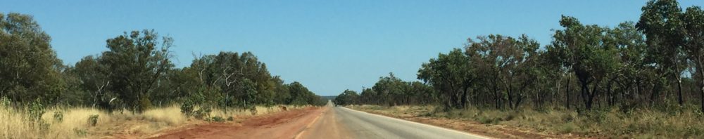
You don’t need to have suffered Sister Rose through fifth form (year 10) Latin to know Nullarbor means no trees. But some things you believe about the Nullarbor are big fat lies, as is a lot of what the nuns told us. While the road referred to as “crossing the Nullarbor” runs 1194 kms from Ceduna to Norseman, the treeless Nullarbor is only about 350kms. What’s more, big shock: it has trees. Yes, most of it is low scrub but there are trees. Not towering eucalyptus, granted, but a couple of metres high is a tree in my book. Now, are you sitting down? It RAINS on the plain, and we are not in Spain.

And despite the advertised kangaroos, wombats and camels, do we see any? No.
Out first stop is only 130km from Ceduna and we take a 20 km detour to Fowlers Bay. The sea grass we have seen on all the beaches so far is a variety found only in South Australia and it appears here in haystack proportions as a storm last week pushed it up onto the beach. There is soft white sand underneath and it also forms dunes back from the beach. The settlement has no power grid and is strictly solar, the water supply coming from the skies, or drawn from soaks under the dunes, which Aboriginal people used for centuries.

The dunes aren’t massive, but they are beautiful and we do not realise how beautiful until we take the 4WD road around the back and down the long white beach behind them. The views out over a series of long while sand bays is gorgeous, but the crumbling cliff edges reminds us how fragile the coastline is, and how violent the weather must be at times. We have to drop the tyre pressures to drive along the appropriately named Scott’s Bay, but the Landcruiser takes it all in its stride.
Second stop is another 200 odd kms on at the Head of Bight, allegedly the most spectacular land based whale watching site in the world. There’s a boardwalk out to several viewing platforms on the edge of the crumbling cliffs. Southern Right whales migrate past here between May/June and September. The mothers give birth here and the shallow waters are perfect for the babies to grow and learn how to be whales before heading back to the Southern Ocean in October/November. We see a few spumes indicating whales coming to the surface but it’s a bit early in the season, so we fold our metaphorical tent and continue west. The Head of Bight is 25km out from the Nullarbor roadhouse, which should really fly a pirate flag as it robs you blind for diesel; $1.92 a litre, when the most we’ve paid to date is $1.44.
We free camp overnight on one of the many rest/camping areas off the road. It is a huge area with lots of trees and evidence of many previous tenants in the form of fire places and wheel tracks, but we are the only ones this night. We scavenge wood and light a fire in time for a beautiful rainbow to shower us in gold – in our case a gin and tonic.

It is a quiet night until there’s a downpour at 3.00am, another at about 5.30. The drive today is alternating showery and sunny spots, though at one point I almost stop as it rains so heavily I can barely see the road in front. We side track to take in a couple of lookout spots for the Bunda Cliffs which stretch for 100kms along the Bight. It is here you clearly see the differentiation of the limestone layers that makes up the Nullarbor – the world’s largest flattest piece of limestone at 200,000 square kilometres and up to 300 metres thick.

We arrive at the Border Village and Checkpoint Skippy to cross into Western Australia.

We have to complete Western Australia’s G2G pass before crossing the border. I won’t bore you with the meaningless and pedantic questions on the multi page form, but the police have all our info on-line and check our data and identities. As an aside no-one seems to know what G2G stands for but I think it is good to go. If you have been in Victoria within the last 14 days you are turned back: in fact we meet a young family who had one day out of 14 in the North of Victoria, nowhere near Melbourne and the COVID outbreak, and they were turned back. After the police interrogation we are frisked for fresh fruit and vegetables by a quarantine officer, who seems particularly keen we don’t have potatoes or onions. I don’t know what they have against a potential hash brown outbreak, but we are nightshade and allium free.
We’ve made it to WA. Only another 700 kms to Norseman, and the end of the Nullarbor.
Love the kangaroo with the vegemite!!
I would love to see a wombat so I expect a photo if you get close to one please.
Yeah. Wombats are my fav marsupial
Sadly the only ones we’ve seen so far have been flat
I love these roving reporter updates. So lucky to have the HG to be Mr Practical.
Amazing photo of the limestone layers. Thanks. Safe travels. Xx
Sounds like you had the same nuns as me! 😜
oh yes…..
Hiya Bev and Scott. Sounds like fab trip. John will email you my sister’s details who lives in Bakers Hill about an hour east of Perth. You could look her up. She would love to see you, I’m sure and show you some local highlights, if you are keen
That’s be great – will most definitely get on touch
Hi Bev, thanks for featuring in your blog, it’s a great adventure and I luv u dearly xxx
You are a great photo model xx
Great pic of Scott’s G&T with the fire and the rainbow
thanks Paul. Hope you had a happy birthday.
Good to go is a logical interpretation, as we would expect of you Bev. It’s actually government to government, with the WA government using the G2G pass for all internal and external arrivals. We’ve had G2G in NZ since 2014, enabling NZTE to forge links with other countries. Loving your blog. Thanks for dispelling the various lies about the Nullarbor. Need some of their rain here please.
Thanks for the clarification! Hope you guys are well. No more rain since – how about you?
Really enjoying the blog Bev. So much better than a hasty postcard. 😊