One trip ends…and another one begins

What could be more wonderful than the ferry from Tasmania arriving into Geelong three hours late, at 11:30pm? Only one thing: a midnight arrival at the caravan park to find the gate code they sent doesn’t work. Oh joy! 

Fortunately another late arrival uses their code and we don’t have to camp on the side of the road.

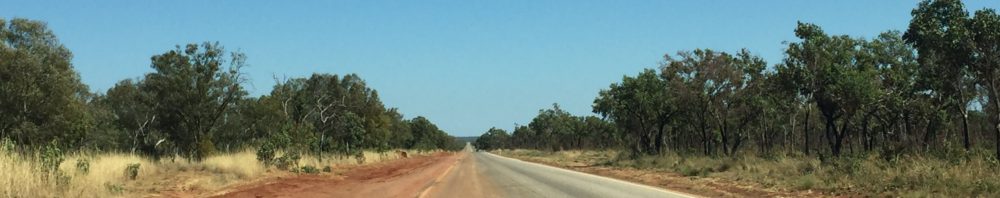
We’re on a mission to drive the 1,645 km to Queensland where we plan to store the caravan for a few months. We take the Hume Freeway and our first stop is Glenrowan. If you don’t know, Glenrowan is the site of Ned Kelly and the Kelly Gang’s fatal last stand. This town is all Ned Kelly all the time. A new Ned Kelly Centre is under construction at cost of $3.5 million. Priorities, priorities.

In a last minute decision we to go to the museum – it advertises an animatronic experience: a what you say?

We move into a dark room which recreates the Railway waiting room; the Police are taking the train to Glenrowan where they hear the Kelly gang are resting. For the next 35 minutes we see the famous story from multiple points of view. We progress through several rooms, each with animated life-like mannequins (this is the animatronics bit) conveying the story. There is elaborate staging and multiple special effects. It’s not the Marvel universe, but it is engaging.

One minute we’re in a rowdy pub with a band playing while the barkeep serves customers; we’re on a verandah witnessing the final gun fight; we’re in the burning house where the gang take refuge. The room is full of smoke (steam) and the sound of crackling flames. Suddenly the roof caves. There are gasps. Someone swears (me). Two children are traumatised for life. And that’s before we witness Ned’s hanging.

After this we need a drink. A temperature of 33C means where’s the beer? We find Red Dog Brewery, which turns out to be a vineyard and winery as well. Peter, the current patriarch, is on duty and the man can tell a good story. Or ten. His grandfather not only planted the first vines, small blocks of Trebbiano and Shiraz, in 1919, he also built, by hand, the cavernous cellar in which we stand sampling some good beer and drinkable wine.

I engineer our trip so Scott can see the Dog on the Tucker-box at Gundagai. There’s a famous (in Australia) statue, inspired by a bullock driver’s poem, Bullocky Bill. The mythical dog loyally guards his owner’s tucker-box until death. You can read the full story here. Excitement builds as we approach the site, and….. well, there’s the tucker-box, but where’s the bloody faithful dog? So much for loyalty. Walter has to sub in.

Many ask where we leave the caravan when we return to New Zealand. It varies, as it depends on where we end the trip. This time we head to Ballandean, just over the NSW border into Queensland, to friends who have a vineyard and winery Just Red Wines on the Granite Belt, a lesser known winemaking area of Australia. The region is elevated and specialises in cool climate wines, and you will find varietals not typical in other regions: whites such as Alvarinho, Marsanne, Roussane, Vermentino and Petit Manseng, and reds such as Durif, Petit Verdot, Tannat, and Nero d’Avola.

The Just Red property has two accommodation cabins with lovely views over the vineyard, and bush over a few acres at the back. We bring some track markers to replace the fading strips that mark the trail and that will be our first job when we return.

Oh, look at that – we’re back! It takes a couple of days to mark, and check the marking, of the trail. We call it blazing, but Australians don’t like that word, especially when you are talking about the bush. As you see, the Granite Belt is aptly named as the trail not only leads through towering native trees, but traverses the massive boulders that give the area its name.

So here we are, back in Queensland and this is the final caravan excursion for us before we sell up. In the meantime we are heading north along the Queensland coast: first stop Dicky Beach, a destination we remember enjoying back in July 2019 – our first trip. Seems like a long time ago.

Beaches, Bays, and Breweries

And wineries, but that spoils the alliteration. It all sums up the east coast of Tasmania, so what’s not to like? We admit we do not carry out exhaustive tastings at all the wineries, but we find few wines we really like. Most vineyards are also wineries, some with a bewildering number of varietals growing in tiny amounts. Almost all produce Chardonnay and Pinot Noir and so, invariably, they offer a Sparkling wine or two. Which tells you something; when you can’t ripen or have to pick early, you can always make bubbles. And we taste a lot of very drinkable bubbles, so actually, who’s complaining? We find little to rave about however, with a couple of notable exceptions: Gala and Sinapius, both with excellent cellar door staff and good wines.

Scott sampling at Gala Wines

And then there are the gin and whisky distilleries. And breweries. And breweries also distilling. It’s a wonder the streets of Tasmania don’t resemble the 18th Century Hogarth drawings, showing the drunken debauchery the demon drink visits on society. Figures vary, but Tasmania has more whisky distilleries than any other state, about 70 gin distillers and more than 20 breweries.

You could never accuse Tasmanians of being wowsers. We see more than one bumper sticker proudly proclaiming “I’m not drunk, I’m Australian”. And get this. Tasmania also has a huge poppy growing industry, growing half of the global supply of legal raw material for pharmaceutical processing. Drink and drugs – where’s the rock and roll?

Bay of Fires Conservation area

The bays and beaches along the east coast are lovely. We look forward to this area as Tourism Tasmania heavily promotes Wineglass Bay, in the Freycinet National Park, and the Bay of Fires in particular. The sand is astoundingly white and the water as clear as gin – without tonic or lemon. Not always the case, as Wineglass Bay once ran as red as claret with the blood of whales hunted and then processed in the bay. Not so romantic a name then, as one might think.

It is the orange lichen-covered granite boulders that gives the Bay of Fires its name. Binalong Bay at the southern end of the Bay is paradise. It has the white sand and the water is the cleanest and clearest we have ever seen. the water temperature isn’t exactly tropical, but it is still swimmable – what we call bracing on first approach, moving to lovely once you are in.

Scott is delighted to find oysters for sale at $14 a dozen, unopenend. A trip back to the charity shop – the first time was to replace broken wine glasses – for a suitable knife, and he is one happy fellow. He immediately corrupts the neighbours’ 8 year old, who takes to oysters like a professional; the four and six year olds aren’t so sure.

I know the world is divided into two types of people, those who eat raw oysters and those who would rather poke their eyes out with an oyster knife. I’m in the latter group. Over our seven weeks here I lose count of the many dozens of raw oysters Scott consumes. I would eat them deep fried – to be fair I’d eat most things deep fried – but restaurants only offer natural or oven baked. Really, oven baked.

Binalong Bay, Bay of Fires. White sand and clear water

Port Arthur is famous for being both an early convict settlement and, more latterly, the site of a mass shooting in 1996. The site of the massacre, the cafe, is now a memorial garden. The historic settlement covers many hectares, but the main buildings are easy to walk around, and have plenty of information boards. The visitor centre houses interactive displays, short films, personal stories of convicts, and often details of what ultimately happened to them. Not always a happy ending.

Port Arthur historic settlement

The settlement is only accessible by boat or across a slim isthmus, so potential escapees either swam, or faced kilometres of heavy bush before being met by dogs, vicious through underfeeding. Guards would let them loose to chase those seeking freedom.

We are now leaving, but not escaping, Tasmania. There are places we would be happy to return to, and some lovely people we would like to see again. As I write this we are sitting in the queue of cars waiting to board the Spirit of Tasmania back to the mainland. So far it’s one and a half hours late.

Who knew Tasmania has a Lake District?

I left you wondering, perhaps even worrying, about the next part of the journey from Strahan. It’s true, we thought we had left the worst roads behind us, but we now know there’s always something new to test your nerve. Queenstown, about 80kms inland from Strahan, is a copper mine town with a bewildering and empty landscape at odds with the wilderness that surrounds it. In the 1800’s they stripped all the trees, bushes and soils, as the sulphur produced by copper smelting kills the land. What’s left is what greed looks like.

The road in from Strahan is much as we expect, but the road out shows us why most people take the 100s of kms detour back north to go south to Hobart. Yes, people look at us strangely when we say we’re taking the Queenstown road, and we soon understand their puzzlement. The road is unlike any mountain road we’ve ever driven – anywhere. Certainly not dragging a 3.5 tonne caravan. Sheer rock one side, sheer drop the other. Pick your adjectives from steep; hairpin; precipitous; narrow; vertiginous; sheer; slow; suicidal. There are times we are going so slowly it would be quicker to get out and walk.

A break at the top of the range between Queenstown and Linda.

But we make it, nerves mostly intact if a little frayed, down the other side and find a lovely cafe in the literal middle of nowhere. Nothing else. Just a great cafe next to the ruins of the Royal Hotel Linda. They do a great Reuben sandwich, but I don’t recommend the trip to get there.

for a great Reuben sandwich

The Central Highlands surprise us – in a good way. The area is a labyrinth of alpine lakes and tarns, dolerite peaks, and alpine forests and vegetation. They call it the Land of Three Thousand Lakes though I’m sceptical anyone actually counts them. The largest is the Great Lake at 176 square kms. There are also lots of walking tracks, short and long, up and down and over ridges and peaks.

Yet the most remarkable attraction is man made, the Wall in the Wilderness at Derwent Bridge. (No photos allowed so use the link). The Wall is a 100 metre long wooden sculpture by artist Greg Duncan, and relates the region’s history. It is still a work in progress and it’s interesting to see his process sculpting laminated Huon pine. Some panels include the work of the hydro workers who built the dams and laid the pipes for hydro electric schemes across the highlands.

We are in Hobart to coincide with the arrival of the Sydney to Hobart yacht race. No, we don’t wait up until 1.00am to see the Maxi yachts arrive. Later that morning is interesting enough; wind absent for the previous 48 hours kicks up and catches those arriving around lunchtime. Tricky reversing manoeuvres ensue, give us plenty to watch. We empathise on one level, as I have a habit of guiding Scott into tricky caravan turning or parking situations – don’t ask.

We “do” all the things you do as a tourist in Hobart – Salamanca Markets; MONA (Museum of Old and New Art); Botanic Gardens; and historic places, such as Kelly’s Steps, pictured above. In 1839 convict labour cut these steps into the stone of the cliff dividing Battery Point and the harbour. That same stone quarried from the cliffs built the warehouses that line the wharf. These are the restaurants, shops and bars on what is now Salamanca Place. We leave Hobart feeling we could spend longer. It’s a charming city, just 244,000 people, but sitting as it does on the water with the river and the harbour, hills all around, lovely 18th Century architecture, it’s somewhere that would reward more time.

Kelly’s Steps, carved into the stone cliff

And I’d like to go back to MONA as you can never see it all at once. We take the boat up and enjoy some river views and Mimosas from the Posh Pit of the ferry. On arrival we climb up 99 steps to the expansive grounds. When we enter we descend several floors back to water level and work our way back up. No outside light and no clocks – just like a casino. And like a casino it’s a gamble you’ll get what you want. Everything you have heard about MONA is true – if you have heard about it at all. Art that isn’t a landscape of a portrait isn’t for everyone, but if you like a bit of provocation with your art it delivers on every level. It’s not every day you see a sculpture simulating the digestive system from mastication through to defecation.

From entry to exit, here’s your gastrointestinal tract

The Cloaca Professional (is there an amateur category for pooing?) or Poo Machine as it is more affectionately known, is fed twice a day and evacuates its “bowels” at 2.00pm. We didn’t wait for the poop to drop. Apparently it stinks.

Departing and Arriving, rinse and repeat.

Everyone has their own travel horror stories but I’d hate for you to miss ours: I was unable to check in online, so we get to the airport extra early to find most other people couldn’t checkin either. In addition, a zombie apocalypse had wiped out all Air New Zealand staff, leaving a planeload of confused passengers wondering why they hadn’t booked a different airline. Even better, on arrival at Melbourne three Customs agents attempt to screen approximately 10 plane loads of passengers, something akin to squeezing toothpaste through a pin hole.

Minor problems in the greater scheme, I know. I feel for anyone flying over the Christmas period this year, as this is still early December. We have the weekend in Melbourne then head down the Mornington Peninsula and pick up the caravan. On discovering there is a ferry that runs across the entrance of Port Philip Bay from Sorrento to Queenscliff, we rejoice: we won’t have to run the motorway gauntlet back through Melbourne to Geelong to catch the ferry to Tasmania.

The coast at the end of the peninsula is lovely. You can see on the map it is very narrow, and beachside campgrounds run from north of the charmingly named Rosebud, down to Sorrento. There are very, very few people here yet, but I envisage the chaos it must be when the hordes arrive after Christmas, with kids, boats, jet skis, too much booze and entitled attitudes. When we arrive at our site just out of Rye it is so hot (32C) we fall into the ocean, limp with gratitude.

However, that’s possibly our first and last swim if current weather is anything to go by.

Although this map shows the Spirit of Tasmania leaving from down town Melbourne, in October 2022 the new terminal at Geelong came on line.

The ferry the Spirit of Tasmania runs across Bass Strait from Geelong to Devonport, a small town on the north coast of Tasmania. The trip takes between 9 and 11 hours, and the ferry itself is reassuringly massive: almost 200 metres long, 11 decks, a max capacity of 1400 passengers, 750 berths, 500 cars, plus 110 trucks (trailers).

We are on an evening sailing, departing at 6.45pm but they check you in, do a Agriculture check for forbidden fruit and vegetables (Tasmanian border control) then you sit in a queue for ages. We’re almost the very last on and a deckhand indicates a skinny lane – walls on each side – on the vehicle deck. Cue drama as Scott runs too close on one side and touches the wall. As he backs up the scraping noise sounds like a tribe of banshees wailing and I fear we’ve wiped the side off the caravan. In fact the damage is negligible, a scuff at best, but I’m sure you all won’t let that stop you ribbing him.

Our Deluxe cabin comes with a bottle of rather nice Pinot Noir which we drink with a rather average dinner. Over the course of the night I wake a few times as the ship thumps through what must be a bit of heavy sea, but it’s not enough to worry about. A wake up call comes at 5.45am – groan – for disembarkation at 6.30, but I get the feeling we have been in port for a while. Devonport still sleeps.

The virtue of being last on is we are first off – we’ve arrived. Tasmania.

And now, the end is nigh – at least for now

Melbourne greets us with a slap in the face: after five months of small towns and country roads, the multi-lane M1 into a city of 5 million is a shock. How do people live here and do this every day? Yet we survive, thanks to Scott’s cool head and my navigation – the nav in the car needs a software update and has a reputation for sending us off into places we just do not want to go. I do not need to hear “make a legal U turn a head” ever again.

We spend our final couple of weeks meandering down through inland NSW into Victoria. A notable features in this part of the outback is the number of mullets, and I don’t mean the fish. I guess it goes with the territory when you not only have a Shire of Bogan (see previous post), but when those admirable role models of taste, inclusiveness and classy behaviour – rugby league players – wear the “yes your Honour at the front, party at the back” style.

Weather-wise, the temperature is decidedly cooler, and everyone complains about how wet this Spring is. Except the farmers, who unless its a raging flood, never complain about the rain.

In Narrandera we hope to join the annual koala audit – yes there is such a thing. The Koala Reserve just out of town is an ideal koala environment – river red gums are a great source of food and the Murrumbidgee River offers a cooler location on hotter days. Historically there was a large population of koalas, but by 1972, at a time when none had been seen around these parts since 1900, they were re-introduced into the district from Victoria and Queensland. Through heatwaves, flooding and fire, a healthy population survives and there are well over 200 of the furry cuties sitting up in the trees. Unfortunately for us, the shire cancels the annual audit as the Reserve itself is a lake after the recent rain. Between downpours, we take a walk along the trail at the edge of the Reserve and are lucky enough to spot two damp koala bundles huddled up in forks of the tall river gums. They are not marooned but can move from tree to tree if they need to, as apparently koalas can swim – who knew?

Walter regards his portrait

Australians love to slap a mural on a water tower or silo and Narrandera is no outlier. And it is lovely, featuring a big smiling koala along with the Murrumbidgee River, a plane, a tower and a paddle wheel. The Tiger Moth represents Narrandera’s location as one of the many Elementary Flight Training Schools (as is Temora) set up in World War One.  The tower is the Oakbank Brewery Tower signalling early prosperity, the brewing industry having its heyday between the 1890’s and mid-1920’s. Though it’s not as if they don’t drink now – the town has 5 pubs and a population of 5,000. The paddle wheel signifies the historic river trade when from 1858 paddle steamers carried wool and stores for 360km between Narrandera and Hay.

It’s all about the rivers in this part of the country, and a river is the border between NSW and Victoria. We have a few days at Echuca, which takes a few hours of practice to pronounce correctly. It’s a bit like a sneeze with an ‘a’ on the end. On our first trip we spend some time at Mildura, 377kms from Echuca by road, but you can probably triple that by river distance. I have to laugh, wryly, reading my 2019 blog about Mildura and environs – it was the worst drought in a century. This year the Murray is running high and we see flooded walkways and sunken jetties. The river is running quite fast and when we take a riverboat cruise it feels like hard work for the paddle steamer to make way up against the flow.

submerged walkways at Echuca

And so this five month journey ends. We visit a friend in Ballarat then brave the urban jungle. At this point we introduce Little Doggy, my younger (but still old) brother Ian, and his wife Julie to Walter, our faithful koala companion, and transfer him to their care for 6 weeks. People tell us we are brave and generous, as it means we are lending them the Landcruiser and caravan as well. Not brave, just trusting.

will they take good care of Walter? I’m worried

For this trip the odometer tells us we have driven 17,500 kms (we’re up to 52,000 over the three trips so far). The cheapest diesel this year was $1.98 and the most expensive $2.49, and although I save all the receipts (why?) I refuse to add up the total.

and we spent this much on diesel

In December we fly back to Melbourne to take Walter back into our care, and head across Bass Strait to Tasmania for a couple of months. As we’ve travelled through the shire of Bland already, I look forward to more excitement. Tasmania is like New Zealand many tell us. We’ll let you know.

Honesty is the best policy

There’s water under here

Judging by these last few blogs, I seem to be developing an obsession with water. We tend to think of inland Australia as a huge desert, and by and large this is true. However as we cross into Northern Queensland we remember the Great Artesian Basin (GAB), sits beneath us. It is one of the largest underground water sources in the world, and Australia’s largest groundwater basin, holding 8,700 million millilitres. I’m not sure what that looks like, but I am sure it exceeds Department of Health daily guidelines. Much of the water in the GAB entered when the climate was much wetter and “they” estimate the water in the south-west of the basin is two million years old. Imagine – water off a dinosaur’s back, available for your tap.

red is the intake area, yellow the GAB, blue the concentration of springs, and arrows show the direction of flow

The 1,000+ km drive from the NT/QLD border through to Townsville on the east coast sees us retracing parts of our 2019 trip across Northern Queensland. Revisiting Camooweal, 14kms over the border, we find little has changed except the price of diesel – this from my July 2019 blog Not surprisingly, you pay more for things the further you are from civilisation, or competition. The least we’ve paid for diesel is $1.45 a litre (there’s no road user tax) and at Camooweal we pay the most at $1.82. Oh how we laugh to read that. We do not recall paying less than $2 a litre anywhere this year and Camooweal is charging $2.67. I also note it was 35°C (Sept 2019) and this year, in July, it’s a more manageable 26°C.

We don’t go back to the caves, but do take the time to visit the excellent Drovers’ Museum on the outskirts of town. There are fantastic displays including maps of the old stock routes, but best of all we have an old codger telling us about everything we ever wanted to know (and more) about droving.

Droving routes, taking months to get thousands of cattle to rail head or ports

The head drover hires on the other staff, gets the supplies in – which he is unable to pay for until he is paid on delivery of the stock – and to manage the whole drove from start to finish, including finding grazing and water. The horse tailor, a great job title and nothing to do with fashioning outfits for the men or the stock, has to look after about 6 horses per stockman plus 20 or so pack horses, depending on herd size, balancing the loads, knowing what’s in every pack, which horse is for which stockman, and so on. The cook manages supplies, though with basics of salted beef, damper and tea there’s unlikely to be any Instagram worthy pics. Men might be two years on a drove, travelling to the station from a distance, and then about 8 miles a day driving the stock to the railhead or port. Wearing the same set of clothes. Those were the days.

The very definition of wide open space

The landscape we drive through does change. There are vast sunburnt plains of desiccated grass where massive acreages of cattle stations eke out their existence. Sometimes there are fences lining the road, often not, and the evidence of wandering cattle is a beast four legs to the sky being ripped apart by raptors. Wedge tailed eagles, kites, and screaming crows circle the skies looking for an easy meal of roadkill and seldom experience disappointment.

The road surfaces vary but there are a lot of long straights. The colours change from rich robust reds to softer pastels of mauve and dusky pinks and greys. The night skies are spectacular. With no ambient light for hundreds of kilometres the constellations are easy to find – well they would be if you knew them – and the stars shimmer. One of the challenges when taking photos in the outback is scale (and only using an iPhone). To get any sort of panoramic shot trying to show the vastness of the scene, you find everything fades into the distance.  If you zoom in, you lose the magnificence you want to capture.

Mount Isa is not a place to linger in our experience, unless it is for the rodeo, which we gave a good nudge in 2019, so we bypass and carry on towards Julia Creek. We are meeting Emily, an old friend who is in her camper van travelling down from the North. In the meantime we rendezvous at a free camp at Corella Dam with new friend Erica and her mate Trev. We met Erica last year when she was managing the station stay at Peedamulla in WA. This is another joy of life on the road – the opportunity to meet some cool people, and then arrange to find them again on your next trip! We circle the vans as if we are a wagon train. If you were born before the Bag of Pigs invasion and your family owned a TV set you will know about circling the wagons and remember the TV show Wagon Train – or Gunsmoke. Or The Virginian. Or Rawhide. Spuds roasted on the edge of the fire, marshmallows in the embers later and plenty of wine. Time with friends is seldom wasted.

So we do it again. This time with Emily and exploring the wonders of Julia Creek, where we learn about the aforementioned GAB, and the tiny marsupial, the Julia Creek Dunnart. if you’ve never heard of a dunnart I am not surprised – this country has a never ending supply of largely anonymous marsupials. This one is as small as a mouse and a lot cuter. It is also endangered so they are fencing off a little sanctuary to increase numbers. Clever little thing that it is, having stuffed itself silly in the good times it stores fat in its tail – no body shaming from me – and then in the dry season when there’s little food, it shelters within the cracking clay soils, living off its stored fat.

The Julia Creek Dunnart

There are quite famous artesian baths at Julia Creek – can’t stop that hot water bubbling up -but the air temperature (34) is hot enough we opt for the swimming pool. It literally takes our breath away – the water is about 16 degrees – funnily enough, we are the only ones in the pool.

Drifting across the Northern Territory

It may surprise you to know that the Northern Territory has many National Parks with beautiful river gorges, waterfalls, hot springs and many natural features aside from desert, killer crocs, vicious box jellyfish (can kill you in 2-3 minutes), deadly snakes and racists. In 2018 we visit Darwin and the 20,000 square km UNESCO listed Kakadu National Park – by the time we exit the park I’ve definitely had enough of crocodiles, we don’t encounter box jellyfish, see no snakes, and the last one, well, unavoidable. Early explorers, lacking both imagination and zoological expertise, named the three big rivers in these parts West Alligator, South Alligator, and East Alligator.  They’re crocs mate.  

Our river trip on the South Alligator  takes us to Cahill’s Crossing, a remote river ford that crosses into Arnhem Land.  The tides at the Top End reach highs of 11.8 metres, so there’s LOTS of water rushing up stream as the tide comes in, and just as much rushing out when the tide goes out.  This creates the perfect conditions for idiocy and bravado as vehicles cross in unsuitable circumstances and frequently get washed into the croc infested waters.  You’ll find a  good summary of the crossing at https://www.youtube.com/watch?v=8ojzUCDR6lg but to see Darwinism at work, google Cahill’s Crossing on youtube – but beware of going down a rabbit hole.  

That was the 2018 trip, so this year we are really just passing through on our way to the East Coast. Yet there’s plenty to attract us closer to Katherine, even if the town itself is a crossroads you pass through. We choose a farm campground about 20 kms out of town and near the Katherine River. From here we can day trip up to Edith Falls, which aren’t spectacular, but the lake at the base is large, lovely and perfect for swimming.

Edith Falls – not so much falling

Although I am aware of the expression ‘the never never land’ until now I don’t know what it’s about. The area about 100 kms south of Katherine was made famous by Jeannie Gunn’s (largely autobiographical) 1908 novel We of the Never Never, written about her life on nearby Elsey Station. The expression comes from the saying that they who have lived in it and loved it, Never-Never want to leave it.

It is a beautiful area, enhanced by the towering palms leading to the sandy bottom thermal springs. However it’s a smaller pool than the nearby Bitter Springs which we prefer. More palms and woodlands, with crystal clear waters and a slow river current than allows you to drift for about 15 mins then climb out at the end, then walk back along the path to do it all over again. It is particularly lovely first thing in the morning – I know, it is almost becoming a habit – when there are few people, lots of birdlife, and steam coming off the water. With masks and snorkels we see a little underwater life, tiny fish and a few little turtles. The spring is associated with a massive limestone formation reaching from north of Katherine to the Queensland border. Most of the limestone is below ground and in the wet season the water is absorbed by the porous limestone and heated by the earth, emerging as perfectly clear 34 degree C springs.

morning swim at Bitter Springs

We decide to go to see a whip cracking show a few kilometres away one evening, even though it necessitates a night drive – something we usually don’t do in the countryside to avoid hitting kangaroos that spring out of nowhere and hop across the road at night. I am driving when suddenly Scott shrieks STOP! I don’t see a kangaroo, but there’s the biggest blackest feral pig you will ever see, broadside on to us, gorging on roadkill kangaroo.

Nathan “Whippy” Griggs puts on a good show. What he lacks in subtlety -“youse all here to see me crack” – he makes up for in talent. He has bunch of Guinness world records in whip cracking (who knew) such as longest whip crack at a staggering 100metres, and most whip cracks in a minute. He is pretty good at cracking to music, and I suggest you check out his youtube, particularly if you like AC/DC.

By now you may realise these blogs lag behind real life. I need the right combo of time, inclination, motivation and material to make these happen and they don’t always coincide with location. We are now in northern Queensland, but more on that next time.

It’s all about the pearls

Broome is a interesting town with an ironic history: a booming pearling industry in the late 1880s sees more Japanese than European settlers living there, and a strafing attacks by Japanese Zeros on the 3rd March, 1942. Since our last visit in 2018, when there was no visible story of this major event, most Australians not knowing Broome was attacked, an evocative installation is now at Roebuck Bay. Japanese fighters strafed not only the Broome airfield, but also 15 flying boats at anchor. These were transferring Dutch evacuees to safety from Java which had been invaded by Japan. The nine figures of the installation stand looking out to the site of one of the fifteen wrecks, a Catalina FV-N. There are silhouettes of nine Zeros arranged in three flying formations depicted coming from the southwest, the flight path they took that day. The stories and quotes written on the figures are arranged into 9 themes: The Chaos of War, The Movement of People, The Attack, The Rescue, The Survivors, The Impact, Kudo, The Wrecks, Reflection and Reconciliation. The stories are both heartbreaking and inspirational.

Nine Zeros, Nine Stories on the Roebuck Bay

If is fair to say Broome is the equivalent of a seasonal retirement village. Those living in Perth and south flock north for Winter, many staying at the same caravan park, probably in the same site, with the same friends they have at home. Same, same, but warmer.

On advice from friends we head up the more remote Dampier Peninsula towards Cape Leveque, leaving the caravan in Broome. We remember flying over this wild part of the world back in 2018, and a magic trip to the Horizontal Falls (which I wrote about on my former blogsite). David Attenborough calls the falls the Eighth Wonder of the World. Here the tide runs full tilt between narrow cliffs and appears to flow, well, horizontally.  It is thrilling and mind bending, taking the powerful boats up through the narrow gap where water defies the laws of nature.

The main road up to Cape Leveque is recently sealed, long and straight. We continue past our turnoff and go into the tiny Beagle Bay Community to see Sacred Heart Church – not because I suddenly need to go to confession, but to see the beautiful pearl shell altar and side altars. It is quite spectacular.

The beautiful pearl shell altar of the Sacred Heart church

The Stations of the Cross (ask a Catholic if you can find one) feature pearl shell frames and are painted in German Impressionist style. They date from 1949 and include themes and symbols meaningful to the local Aboriginal community. Yes, someone really thought this.  At the risk of (further) inflaming any Catholic readers, I suggest what happens to Aboriginal people as a result of European arrival is on a par with crucifixion.  I appreciate the beauty of the church from a purely aesthetic viewpoint.

From Beagle Bay to our accommodation the 26km road is a 4WD track, and several times I think we may not be going the right way.  Sandy in places, rugged in others with borders of long grass so you can’t really see much other than what is in front of you. Other sections give out wide views across the seedy grass.

And then……. swaying palms, blue ocean, white sand.  

No longer an active pearling factory, the pearl divers quarters are now basic but airy queen rooms:  five opening out on to the water and five facing inland.  We are in the waterfront and thank goodness for the cyclone shutters, which sit at about 60 degrees down, shade the room from the easterly sun, but windows that allow in the breeze.  Anyone who doesn’t believe I am ever up early enough for a sunrise would generally be right. But in this case I have no choice as the dawn shines right in my eyes – until I realise I can drop the shutter the night before.

The days are spent walking, fishing (for Scott), crabbing, talking, eating (crab and fish), drinking, reading, learning about the history of the pearl industry, and pearls in general. Steve, who started the farm in the 1970s, and his partner Erin (a lovely Kiwi) are great hosts and generous with their time and resources.

And a lasting memory of Broome: we go to the Sun theatre, the world’s oldest operating picture garden to see Top Gun, Maverick. Broome airport is less than half a kilometre from the main street theatre, and about half an hour into the movie there’s a deafening roar as a jet flies overhead at no more than 500 metres – it takes a moment to realise it isn’t the movie sound effects, but then we realise – everyone laughs and cheers – go Qantas! That’s service.

The Kimberley region is one of the most remote in Australia, and one of the world’s last wilderness frontiers. The region is three times larger than England with a population of less than 40,000. think about that for a minute. It’s a empty space bigger than Boris Johnson’s ego. Extending over Australia’s entire north-western corner, the Kimberley is  spectacular: rugged ranges, deep gorges, semi-arid savanna and a largely isolated coastline. Broome is the eastern anchor, and we set off to Kununurra, 1,100 kilometres away. come with us.

You should be so lucky, lucky, lucky, lucky (thanks, Kylie)

Lucky Bay has the whitest sand and is widely seen as the best beach in Australia – so, rhetorical question, why wouldn’t we go? I book the campground a couple of months before we leave New Zealand: previous experience tells us popular places get booked early. I pick a date a week after we fly in, hoping we won’t have to isolate on arrival in Perth. Far from it – after weeks of angst working out which forms we need, Western Australia relaxes all its restrictions a few days before we arrive and they wave us through with a lack of interest only a pensioner couple can arouse. 

Sweeping heathlands and dunes lead down to hundreds of metres of squeaky, whiter than white sand, so all the hype is true.

The squeaky white sand is as fine as talcum powder

Indeed all the beaches along this stretch of coast SE Western Australia sparkle with pristine sands, and mercifully the only things missing are cafes, shops, houses, and assholes. We are in the Cape Le Grand National Park and the one park campground – about 50 well separated sites is off grid, so no power or water hook up. We make sure the water tanks in the caravan are full before we arrive although there are clean, well maintained long drop toilets and solar showers available.  Just watch out for the roaming kangaroos that like to wander along the beach or into your campsite when you are lying back on your reclining beach chair, reading.

Bugger off Skippy, I’m trying to read

To arrive at this sumptuous destination we drive 720kms south east from Perth, across vast plains smouldering as in some post apocalyptic nightmare. This is the Wheatbelt, though there’s wheat, canola, oats barley and so on. From mid April to June farmers are seeding this year’s crops, and prior to planting, the stubble is burned off to clear manage weeds and the ground. Unless you see it, it is hard to imagine just how massive these cropping areas are. The WA Wheatbelt south of Perth spans 154,862 square kilometres, but the resident population is only about 75,000 spread across a couple of hundred small towns with populations of between 500 and 1,000. 

One such small, but perfectly formed town is Beverley.  It turns out I not only have a town in my name but it comes with a nifty slogan.

Being very me

I can imagine the town council meeting now. Mayor: We’ve got a new catchphrase, one that’ll have tourists lining the highway to get here – Be Very You. Councillor: I don’t get it. Mayor, with enthusiasm: Come on Ken, it’s great, it’s inclusive and encouraging , you know, to be yourself. And it’s clever – it nearly spells Beverley but leave out the le and add ou. Councillor: Be yourself? How can you be anyone else? Anyway, we don’t want people being themselves if they’re foreign or woolly woofters. Mayor: Ken! It’s 2022, you can’t say that. Anyway, we’ve paid that fancy Perth advertising mob $100,000 so we’re putting rates up to pay for it. Meeting closed.

Back in Cape Le Grand National Park we amuse ourselves visiting some of the other small beaches in the Park, swimming and body surfing in the clearest water ever, walking trails between beaches and, incomprehensibly, scaling a very large rock.

Frenchman’s Peak looms above us

Frenchman’s Peak, so named by surveyor Alexander Forrest for its resemblance to the hats worn by French troops in the 1800s, rears up to 262 very steep metres. A large cave near the summit is thought to have formed by wave action 40 million years ago when sea levels were at least 300 metres higher than they are now. At times we scramble up 45 degrees slopes. When I pause to rest – for quite some time – a young woman below encourages her 10 year old with “look that lady there is as old as Nana and she’s climbing”. His not unreasonable response is “I don’t care, I don’t want to die”. Fair enough but I’m more concerned with how old Nana is. Seventy-five apparently, though Jane has the good grace to say she knows I’m not that old, she was just trying to get the kid moving. There you go, Motivation 101.

Cape Le Grand National Park is the bottom right

Not just swimming with big fish – but that is the best bit

As much as we are enjoying the reef and our snorkeling trips, there is plenty else to do on the Coral Coast. A couple of days in Exmouth mean we can drive around into the Cape Range National Park and take a river boat trip up the Yardie Creek. This quiet cruise shows us the spectacular colours and beauty of this rugged gorge, and we see a number of the local black-footed rock wallaby. they are quite hard to spot against the cliffs until our guide points them out.

the black-footed rock wallaby’s colour is good camouflage against the rocky cliffs

The rugged limestone range that gives Cape Range its name runs down the western border of the Exmouth peninsula. The river gorge only hints at the extensive cave and canyon system that runs through and under the range itself. And, of course, on the Indian Ocean coast are stunning beaches with the northern end of the Ningaloo reef providing more options for water activities.

Exmouth exists because in 1963 the US Navy negotiated the lease of land for a naval communications station to provide very low frequency (VLF) transmission to ships and submarines in the western Pacific and eastern Indian Oceans. The station and town came into being in 1967, with the town providing accommodations for the US families working at the station. Thirteen tall radio towers lend a mysterious air to the tip of the peninsula, six kilometres north west of the town, as we drive to Yardie Creek.

Back in Coral Bay there is the opportunity to satisfy our inner bogan tendencies driving over sandy territory. We take a side by side, rather than a quad bike, as neither of us is a good pillion passenger. I take the wheel for the outward journey and quickly realise the block under the accelerator is designed to tame my inner bogan. Still, its heaps of fun bashing over the sand dunes, drifting around corners and along the slightly more difficult to access beaches. We arrive at a lookout in time to watch the sun sink over the Indian ocean in its usual stunning colours.

ready to rumble

We also take the Landcruiser on a few drives up the coast. This usually involves dropping the tyre pressures to 18-20 psi over the sandy terrain, but I retain terminal horror at the thought of being bogged in the middle of nowhere, dying of thirst and being eaten by termites. The compressor is getting a lot of use reinflating tyres at the end of each foray into the unknown. The reward is in the outstanding coastal views and complete lack of people who could help out in an emergency!

about 40kms north of Coral Bay

But the best part is back in the water. We love our first Manta swim so much we sign up for another, hoping but not expecting it to be better. And it is. By a factor of, I don’t know, a lot. Our run of luck is still going strong as again we get stunning weather. Not only that, but the water is crystal clear, much clearer than last week, and as the mantas favour sandy areas the viz is great. At times we are only a couple of metres above them. Again, it is mesmerising, and as they are swimming relatively slowly we can easily keep up and follow them for some time.

Scott the fishboy swimming with mantas

We find three manta in a mating chain. A mating chain happens when the males encounter a receptive female and they start to follow her. Yes, if this were humans we would be feeling icky. There can be up to 20 or so males following in a well ordered line behind her, and all the time she is assessing their fitness for mating. She may swoop and dive and leap out of the water then race off and quite literally, the last manta swimming gets to mate with her. Mating chains can go on for days as the weaker males drop out. It must be getting down to the wire when we see them as the larger female has only two suitors following. Some manta is going to get lucky soon.

And so ends our wonderful three weeks on the Coral Coast. This is definitely a place to visit, and to linger and enjoy. We snorkel and/or swim off the beach every day, and every day see something different. The weather is sublime, though it is now getting a little hot for us as it is over 30C every day.

We now embark on the final month of this journey which will end in Perth. Further to the last blog, Air NZ has already changed our flights. We still arrive home on the 18th October, but now have a day flight and arrive in the evening, rather than an overnighter.

For those who like flowers and aren’t sick of seeing Mulla Mulla

acres of Mulla Mulla
and the white version of Sturts Desert Pea
don’t know what these are, but they are everywhere

And for the map lovers, the same map applies