As much as we enjoy Kalgoorlie it becomes time to move on. We head south towards the coast, travelling down the eastern side of the Wheatbelt. The West Australia Wheatbelt stretches east from Perth on the coast and covers 154,862 square kilometres in the south-west of the state. In this area there are 200 towns, but the overall regional population is just 75,000. WA comprises 33% of Australia’s landmass (2,529,875 km²). The population is just three million, with two million of this living in Perth, so it is easy to see why the Wheatbelt is so sparsely populated.
In South Australia we had become used to seeing great swathes of barren grain paddocks, with massive machinery tilling – or some other technical term – and either preparing for, or doing planting. I think Scott feels a pang when he looks at the tractors, though he wouldn’t admit to missing his Iseki.

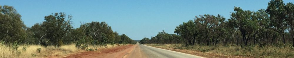
Only six weeks or so later we see the first green shoots appearing in the WA grain fields, but it is still difficult to visualise what they will look like in another few months.
At this point we are travelling on our first extended red dust road, taking the less travelled route south. Forewarned by other travellers about the mess that results from red dust blowing into the caravan through air vents, Scott sacrifices a yoga mat – not my good one – to cut templates and covers the vents. We are rewarded with a dust free interior even if the outside looks like it has taken a bath in paprika.
We are heading to Hyden, aka the middle of nowhere, to check out Wave Rock. Yes, yet another stunning land formation. I tell you this country is full of them. Over millions of years wind and rain have undercut the base of the massive Hyden Rock to create a 15 metre high, 110 metre long curving granite shelf that resembles a gigantic striped surf wave ready to break. It is, quite simply, beautiful. Walking up and across the top gives a sense of how extensive the rock is, and in nooks and crannies there are lovely little pockets of flora.

It is up here we can better see the delicate stone fence built by early settlers to channel the rain into the Hyden dam, built in 1928 for the town’s water supply. Early settlers were drawn here for the sandalwood trees, which they harvested and exported to Asia. In the mid to late 1800s up to 14,000 tonnes was being exported each year. Do I need to say there aren’t many left here? Demand is still great, however, and there is a thriving sandalwood industry, with about 20,000 hectares in plantations.
The top of the wave gives a great view over the surrounding area which features several low lying salt lakes, the remnants of ancient river systems. When the land was cleared of native vegetation to plant crops such as wheat, oats and barley, the shallow rooted crops didn’t soak up rainfall in the same way, so rain water trickled down into the deeper salt deposits. As the water table rose, so did the salt and subsequent evaporation created the salt lakes. There are hundreds peppering inland WA and if you go looking – just google salt lakes Western Australia images – you’ll find gorgeous aerial photos


We arrive at the coast once again, at Albany, and after a week there declare it is a place we could easily live. But more of that next time. For those who asked for more orientation, here’s a map of this blog’s journey.

nice to be near the sea again. Wave rock looked interesting, very photogenic.
All the landforms we see are amazing (in the literal sense) and are worth venturing off the beaten path to see.
Hi Bev and Scott,
I’ve always to wanted to see Wave Rock – it’s amazing and I’m sure it’s overwhelmingly impressive when you’re actually there. Keep safe and travel well.
Paula